

Construction and renovation projects depend on reliable information about the site and the existing building. When project teams work with incomplete drawings or inaccurate dimensions, even a well-developed design can encounter unexpected constraints during execution.
These challenges are particularly common in projects involving existing structures, building extensions, industrial upgrades, and commercial refurbishments. Differences between documented and actual conditions can affect installation sequences, material planning, coordination, and construction decisions.
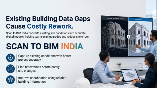
Scan to BIM India provides a way to document existing building geometry through laser scanning and convert the captured data into a structured Building Information Model (BIM). This digital information can help project teams understand site conditions before planning modifications or integrating new construction.
Why Existing-Condition Data Matters in Construction
Construction planning involves coordinating multiple activities, including structural work, architectural modifications, equipment installation, and building-services integration. Each activity depends on accurate information about the space in which the work will take place.
When existing drawings are outdated, teams may discover that dimensions differ from those shown on paper. A structural beam may occupy a different position, a service route may cross a proposed installation area, or the available clearance may be insufficient for new equipment.
These discrepancies can affect construction sequencing and require design changes after work has started.
Reliable existing-condition data helps teams identify these constraints earlier. It also gives architects, engineers, and contractors a shared reference for reviewing the building before developing detailed plans.
What Is Scan to BIM?
Scan to BIM is the process of using laser-scanned spatial data to develop a digital building model.
During a survey, laser scanning equipment captures measurements from visible surfaces. These measurements form a point cloud, which represents the geometry recorded from the scanner positions.
The point cloud is processed and used to create BIM elements such as walls, floors, columns, beams, openings, ceilings, and visible building services, depending on the project’s scope.
Unlike a simple three-dimensional visualisation, a BIM model contains structured building elements that can support dimensional review, design coordination, and documentation.
However, the model does not automatically represent every part of the building. Concealed components, inaccessible areas, and information that cannot be verified from the captured data may require additional investigation.
How Scan to BIM Supports Construction Planning
1. Establishing actual building dimensions
Before modifying an existing building, project teams need to understand its current dimensions. Laser scanning can capture visible geometry across multiple areas, creating a point cloud that can be used as a reference for modelling.
This information can help identify differences between existing drawings and surveyed conditions. It is particularly useful where buildings contain irregular walls, uneven floor levels, or complex structural arrangements.
Accurate dimensions support planning, but critical interfaces should still be checked against the project’s specified tolerances.
2. Coordinating new construction with existing structures
Building extensions and refurbishment projects often require new elements to connect with existing walls, floors, columns, or structural openings.
A scan-based BIM model can help designers review these interfaces before construction begins. For example, teams can examine the relationship between a proposed extension and the existing floor level or check the available space around a planned structural connection.
The model supports geometric coordination, while structural calculations and engineering approvals remain necessary to establish whether a proposed connection is suitable.
3. Planning MEP installation routes
Mechanical, electrical, and plumbing installations must fit within the available building space. Existing ducts, pipes, cable trays, and structural elements can limit the routes available for new services.
Scan to BIM can document visible obstructions and help designers assess proposed service layouts. When the relevant elements are accurately modelled, the team can identify potential spatial conflicts before installation.
Concealed services cannot be assumed to appear in the point cloud. Additional records, specialist surveys, or site investigations may be needed where hidden systems affect the proposed work.
4. Reviewing equipment access and installation clearances
Industrial and commercial projects often require equipment to be moved into plant rooms, production areas, or restricted service spaces.
A model of existing conditions can help teams assess room dimensions, access routes, door openings, and available installation space. Equipment dimensions and maintenance clearances should also be incorporated where they are relevant to the planning task.
This allows potential access problems to be investigated before equipment is delivered or installation work begins.
5. Supporting construction sequencing
Construction sequencing depends on understanding the relationships between existing elements and proposed work. A scan-based BIM model can provide a reference for reviewing where modifications are required and which areas may need additional investigation.
For example, a refurbishment may require ceiling removal before new services can be installed. A building extension may require modifications around an existing structural interface.
The model can help teams visualise these conditions, although detailed scheduling still requires information about labour, procurement, site access, dependencies, and other project constraints.
The Scan to BIM Workflow for Construction Projects
A reliable result requires a controlled workflow from survey planning through final model validation.
Survey planning: The team defines the areas to be captured, the elements that need modelling, and the intended use of the final deliverables.
Laser scanning: Multiple scan positions are selected to capture visible surfaces while accounting for obstructions and access restrictions.
Point cloud registration: Individual scans are aligned into a common coordinate system. The registered data is checked for coverage and alignment quality.
BIM development: Relevant building elements are modelled according to the agreed scope, required level of detail, and dimensional tolerances.
Model validation: The BIM model is compared with the point cloud, and critical dimensions or interfaces are checked against project requirements.
Coordination and delivery: The model and associated documentation are delivered in the agreed formats for use by the relevant project teams.
Each stage contributes to the reliability of the final model. Errors in survey coverage, registration, modelling, or coordinate alignment can reduce its usefulness during construction planning.
Applications of Scan to BIM India
Scan to BIM India can support several types of construction and refurbishment work.
Commercial building renovations
Office buildings, retail properties, and hospitality facilities often undergo changes to internal layouts, ceilings, and building services. Scan-based documentation can help teams establish current conditions before developing new layouts.
Industrial facility upgrades
Factories and industrial facilities may contain complex equipment arrangements, utility routes, and structural elements. A model of existing geometry can support planning for equipment replacement, service modifications, and facility expansion.
Building extensions
Extensions require coordination between existing and proposed construction. Scan to BIM can help document relevant interfaces, floor levels, openings, and visible structural geometry.
Infrastructure and technical facilities
Selected infrastructure-related and technical building projects may benefit from scan-based documentation where existing geometry must be captured for modifications or coordination. The survey scope should reflect the specific asset type and project requirements.
Heritage and older structures
Older buildings may contain irregular geometry or incomplete historical drawings. Laser scanning can capture visible surfaces and support the development of digital documentation for restoration and refurbishment planning.
Scan to BIM India, Dubai, and the UAE
Existing-condition documentation is relevant to construction and renovation projects in multiple markets. In India, Scan to BIM may support commercial refurbishments, industrial modifications, building extensions, and the documentation of older structures.
In Dubai and across the UAE, Scan to BIM services can help project teams document existing buildings before fit-outs, equipment upgrades, and building-services modifications.
Although the technical workflow is broadly similar, each project requires a defined survey scope, coordinate system, modelling detail, accuracy requirements, and deliverable format.
Swifterz provides BIM-related services for projects in India and the UAE. Its Scan to BIM services page can be reviewed when evaluating the scope of support for an existing-building documentation project.
Provider selection should be based on the technical requirements and quality-control process rather than model appearance alone.
Common Limitations to Consider
Scan to BIM improves access to existing-condition information, but it does not remove every construction uncertainty.
Laser scanning records visible surfaces from available viewpoints. Areas hidden behind walls, ceilings, equipment, or other obstructions may remain undocumented. These areas may require supplementary measurements or investigation.
The model also reflects the scope of the modelling work. If a component is absent from the model, project teams should not assume that it has been surveyed or verified.
Other considerations include:
- Scan registration and alignment accuracy.
- Access restrictions during data capture.
- Required dimensional tolerances.
- The level of detail needed for coordination.
- Changes made to the building after the survey.
- The need for engineering verification of structural conditions.
For these reasons, the BIM model should be treated as a documented reference for the surveyed conditions and date, not as a permanent guarantee that the building will remain unchanged.
Best Practices for Construction Teams
To obtain useful results, construction teams should define the intended use of the model before scanning begins. This helps establish which areas need coverage and which elements require detailed modelling.
The team should also confirm coordinate requirements, deliverable formats, accuracy tolerances, and validation methods. Critical interfaces should receive additional attention where small dimensional differences could affect installation or construction.
Finally, the model should be reviewed by the professionals responsible for using it. Surveyed geometry can support design and construction decisions, but engineering judgement, site verification, and applicable technical approvals remain necessary.
Conclusion
Scan to BIM India can improve construction planning by providing a structured digital representation of existing building conditions. Through laser scanning, point cloud processing, and BIM modelling, project teams can examine visible geometry, investigate discrepancies, coordinate proposed installations, and plan modifications with better information.
Its value depends on survey quality, modelling scope, validation, and how effectively the resulting information is incorporated into the project workflow.
For existing-building projects, a carefully planned Scan to BIM process helps establish a more dependable basis for construction coordination and decision-making.
Frequently Asked Questions
What is the main purpose of Scan to BIM in construction?
Its main purpose is to convert captured existing-building geometry into a structured BIM model that supports documentation, design coordination, and construction planning.
Can Scan to BIM reduce construction rework?
It can help identify certain geometric discrepancies and coordination conflicts before work begins. The actual impact depends on data quality, model completeness, project planning, and how identified issues are resolved.
Is Scan to BIM suitable for industrial buildings?
Yes. It can document visible structural elements, equipment areas, and existing services to support facility upgrades and equipment installation planning.
Does Scan to BIM replace site inspections?
No. It supplements site inspections by providing spatial data and a digital model. Critical conditions, concealed elements, and engineering requirements may still need separate verification.
What information should be agreed upon before starting a Scan to BIM project?
The project team should define survey coverage, required model elements, dimensional tolerances, level of detail, coordinate system, output formats, and validation requirements before work begins.